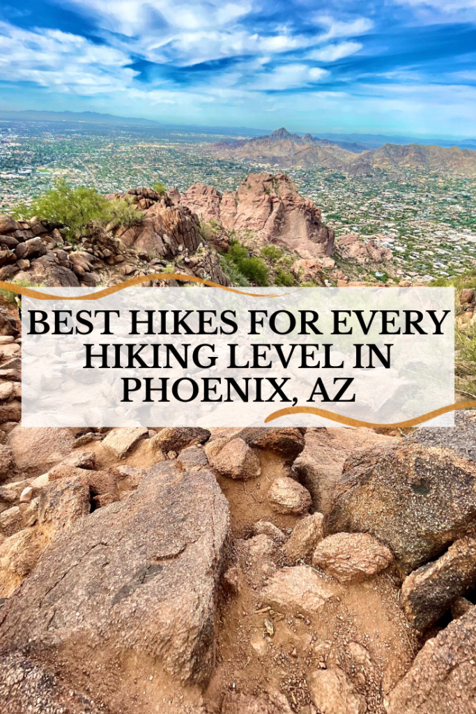
Phoenix, Arizona, is one of the best places in the US for hiking, so if you’re looking for some epic desert hikes, you’ve come to the right place. From extremely difficult to family-friendly, here are some of the best hikes in Phoenix, Arizona.
Contents
- 1 Hiking in Phoenix, Arizona
- 2 Can you hike in Phoenix with kids?
- 3 When is the best time to hike in Phoenix, AZ?
- 4 Top Hikes in Phoenix, Arizona
- 5 Easy Hikes in Phoenix, Arizona
- 6 Moderate Hikes in Phoenix, Arizona
- 7 Challenging to Difficult Hikes in Phoenix, Arizona
- 8 BEST Hikes in Phoenix Arizona – PIN IT
Hiking in Phoenix, Arizona
Arizona is known for its gorgeous hiking sceneries all over the state, but does the metropolis of Phoenix have good hiking? And like the rest of the state, the answer is ABSOLUTELY! Not only is there great hiking inside the city, but there are some fantastic hiking trails surrounding the city throughout Scottsdale, the Superstition Mountains, and the Sonoran Desert.
Can you hike in Phoenix with kids?
We get this question a lot! Many people tend to think of Camelback Mountain when they think of hiking in Phoenix. While this hike is not the kid-friendliest, there are some fantastic trails in the Phoenix area for families with young kids, too.
And if you’re looking for kids hiking poles, check out Mia’s Ultralight Carbon Fiber hiking pole, made especially for kids. Adding hiking poles not only keeps kids occupied, it helps install a love for hiking in a fun way. Since we got her one, we’ve heard less complaining on our hikes!

When is the best time to hike in Phoenix, AZ?
Keep in mind that most of the year, Phoenix is HOT! Therefore, the best times to hike in Phoenix to avoid the heat are late fall, winter, and early spring. That gives you the months of November – March to enjoy temperatures of 60s – 70s. Perfect for hiking! If you are planning on hiking during the summer months, make sure you head out early in the morning or evening to avoid the hottest time of the day.
Top Hikes in Phoenix, Arizona
And with that being said, let’s get down to the information you came for – the best hikes in Phoenix, Arizona! I’ll break them down by difficulty levels: easy, moderate, and challenging/difficult. Each hike will include its location, distance covered, time took to hike, tips, and other information needed for a successful time on the trail. Here we go:

Easy Hikes in Phoenix, Arizona
Looking for an easy hike in the Phoenix area? Maybe you’re just getting started or you have young children who aren’t quite ready for those challenging hikes. Well, Phoenix has some incredible easy hikes for you!
Slate Trail, Cave Creek Regional Park
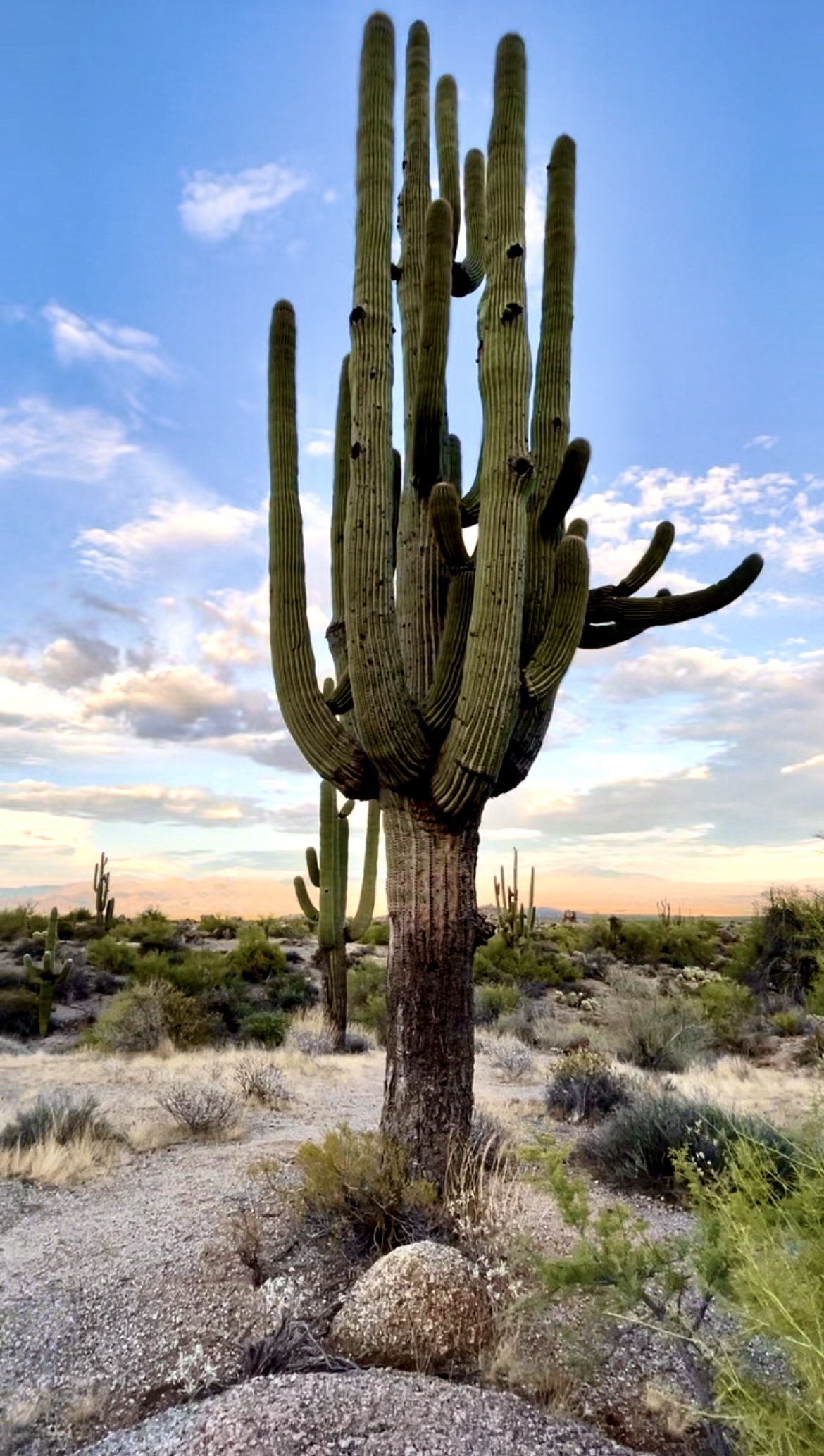
Located in Cave Creek, just outside Phoenix, Cave Creek Regional Park has a total of 11 trails covering 11 miles, most of them categorized as easy to moderate. The Slate trail is considered easy and covers 4 miles (in and out), but you can always stop and turn around if it’s too much for younger children.
The highlight of the trail is spotting the infamous Michelin Man Saguaro – a unique puffed-up saguaro that looks like its namesake. Make sure not to miss it! And as with most trails in Arizona, snakes and scorpions come into play. Just be aware of your surroundings, watch and listen for warning signs.

Besides hiking, you can also horseback along the trail, bike, or camp inside the regional park. And don’t forget to stop in the nature center to get your Jr. Ranger booklet to complete for your children’s badges. It’s always a kid-favorite! Plus, there are cool snakes inside to see!
There’s also a really cool playground near the trail that Mia LOVED! It has a fun scorpion slide, cactus swings, and a bobcat climbing area. It’s also a great place to eat – with a picnic area and restrooms nearby.
How to Arrive: From Phoenix, take I-17 north to Carefree Hwy (SR 74) and go east to 32nd St. (7 miles). Turn north on 32nd St. into the Cave Creek Regional Park entrance.
Hole in the Rock Hiking Trail, Papago Park, Phoenix
Hole in the Rock is EXACTLY how it sounds – a huge hole in a rock. And while the name implies pretty much all that you’ll encounter, this easy hike is completely worth adding to your Phoenix hiking list.
It’s located in the heart of Phoenix, inside Papago Park. The hike level is quick and easy – a mere 0.3 miles. And at best, it will only take about 7 minutes to complete. Once you climb to the top of the hill, you’ll be able to see sprawling views of the city of Phoenix. There’s quite a steep drop-off inside the hole at the top, so make sure you watch your footing. It can be quite slippery after rainy days.

Hole in the Rock is right next to the Phoenix Zoo, so you can add this quick hike to a visit to the zoo. Or bring a picnic lunch and enjoy a nice relaxing afternoon with the ducks and fish at the surrounding ponds.
TIP: If you want the BEST VIEWS, head to Hole in the Rock at sunset. But be ready to face the crowds of all the other hikers who want to see the incredible Phoenix sunset from a great view!
How to Arrive: It’s just 10 minutes from downtown Phoenix, inside Papago Park. Take the N. Galvin Pkwy to Papago Road.
Javelina Trail, North Scottsdale
Located in North Scottsdale right off of North 113 Place, Javelina Trail is a fantastic one for families with little kids. The loop is completely paved, making it suitable for strollers, bikes, and running. It runs adjacent to a nearby neighborhood, so it’s also very safe.
The trail is a 3-mile loop that takes about an hour to complete. There’s a free parking lot at the beginning of the trail that has a cute playground – perfect motivation for your little hikers.
Keep your eyes peeled for javelinas, quails, and lots of bunnies!
Overall, it’s great for families or anyone who wants to just take a nice evening or morning stroll.
Levee Trail, McDowell Ranch, Scottsdale
Another Scottsdale trail that’s perfect for any age or skill level, Levee Trail Hike is located on 104th St. Trailhead. And what’s great about this trail is that it can be combined with Gateway Loop Trail for a full loop of the area or you can simply stay on the Levee Trail – both are easy with awesome desert views.
The trail is 2.4 miles and takes about an hour – more if you combine it with the loop. There is a small free parking lot at the trailhead with more than enough spaces for this low-traffic trail.
We’ve done this trail a few times, and the best time to go is for a sunset hike. Especially in our HOT Arizona weather season. And if you want to see those gorgeous desert flowers, plan a Spring hike – it’s blooming here!
This trail is really easy, making it perfect for kids, surrounded by mountains, and again, we saw lots of bunnies – our daughter’s criteria for a GREAT trail! You can also see other desert wildlife in the area, so always keep an eye out. This trail is dog friendly, but they must be leashed.
How to Arrive: The trail starts at 104th St. in the McDowell Sonoran Preserve, right outside McDowell Ranch in north Scotttsdale.
Gateway Loop Trail, Scottsdale , Arizona
One of our favorite easy hikes in the North Scottsdale area is located in McDowell Sonoran Preserve. This trail is perfect for families – easy terrain, nice facilities, and super dog-friendly. It’s definitely a very popular hiking area, so whatever hour you go, you probably won’t be alone. And our dog, Chewy, met around 10 new furry friends along the trail.
The entire loop is 4.4 miles round trip, about 2 hours, but there are many different off-shoots of the trail for faster and easier hiking. There is also a short nature trail with signs and exhibits explaining what can be found in the area. It’s perfect for kids.
Because the trail is located inside the Preserve, hours are limited from sunrise to sunset, and there is a gate that closes at the entrance right before sunset. And if you go in the early evening, you’ll hit sunset on the way back, which is stunning!
How to Arrive: Located on the east side of Thompson Peak Rd. between Legacy Blvd. and Bell Rd. in North Scottsdale. There are tons of parking spaces in a huge lot with bathrooms and even doggie water fountains.
Moderate Hikes in Phoenix, Arizona
If you’re looking for hikes in Phoenix that are a little more challenging than Hole in a Rock but not as difficult as the infamous Camelback Mountain, there are many options in the moderate hiking categories. Here are some of our favorites:
Marcus Landslide Trail, Scottsdale, AZ
Marcus Landslide is, by far, one of my favorite trails in Scottsdale. Located in North Scottsdale, it’s considered easy to moderate with a 4-mile round trip. It’s about a 2-hour hike, depending on who’s hiking and how often you stop. We made quite a few stops along the way, thanks to those adorable desert bunnies.
The trail is great for kids and adults. It’s not too steep, and there are many educational plaques along the trail. As I mentioned, we saw lots of desert bunnies along the way as well as gorgeous views and scenery. The mushroom rock is a fun formation to stop at as well as other interesting formations along the trail. We went around 5 pm in late Fall, so we caught the incredible sunset on the way back.

There are not many dangerous places to worry about on the trail, but it does get slippery with all the rocky terrain at places. AND, always be on the lookout for rattlesnakes. We didn’t see any, but they are definitely there! As well as coyotes too.
TIP: This is a tremendous winter hike! And if you do hike it during the summer months, head out early morning or late evening to avoid the steaming summer heat.
How to Arrive: From the 101 Loop, take the Pima Road/Princess Drive exit. Go north on Pima Road and turn right on Happy Valley Road and again on Ranch Gate Road. You’ll see the Tom Thumb Trailhead sign – follow it to the parking lot.
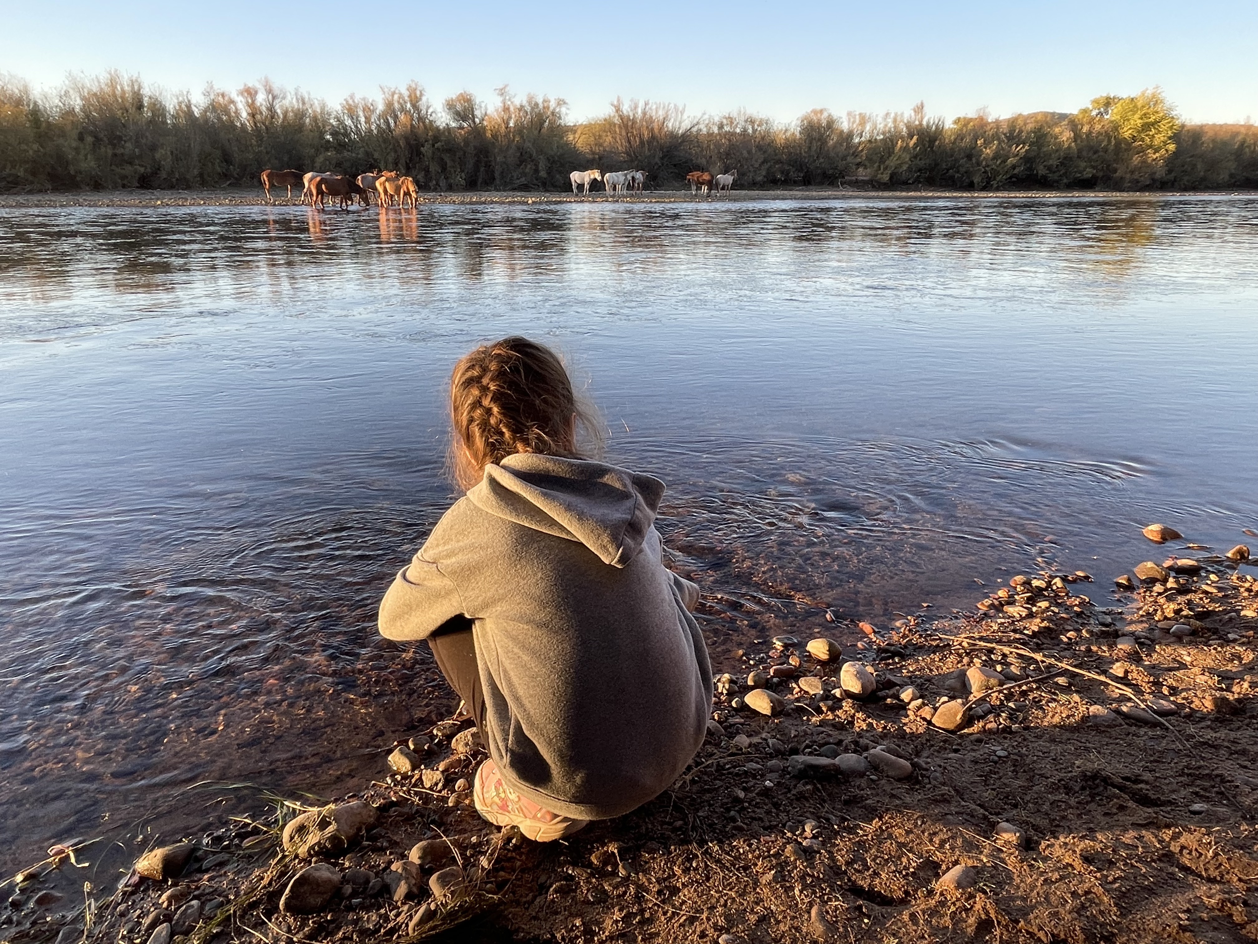
Coon Bluff Trail, Tonto Forest, Arizona
Another great moderate trail in the Phoenix area is the Coon Bluff trail (or loop as it’s also known). Coon Bluff is a popular camping and wild horse sighting inside the Tonto Forest, which makes the trail popular, too. The loop is 2.7 miles and takes about an hour to complete.
Coon Bluff Trail leads to Coon Bluff and down into the Salt River Recreation area. This is where you have the best chance of seeing the gorgeous Salt River wild horses that run wild in the area. We spent the day in the Tonto Forest and finished it off at Coon Bluff. And the highlight of our trip was seeing the wild horses drinking at the river.
There are also camping facilities at the Coon Bluff Day Use Area & Seasonal Camping Site. You can also gain entrance to the hike from the camping area as well as fishing, kayaking, swimming, and other recreational activities.
TIP: The best time to see the wild horses is right before sunset or early morning when they head to the river for their daily drink.
How to Arrive: From Phoenix, take the US 60 to Power Road exit and continue to Bush Highway. You can reach the trailhead from Phon D. Sutton Recreation Site Road or join the trail at Coon Bluff Road.
Blue Wash Waterfall Trail
If you’re looking for a unique hike in Phoenix – one that ends at a waterfall, then you must add Blue Wash Trail to your list. It’s located just north of Scottsdale in Carefree inside the Tonto National Forest. The trail is 2.8 miles and takes about an hour and a half in total.
Hands-down, the BEST thing about this trail is the small waterfall at the end. And when I say small, I mean small – so don’t expect a huge amount of water. BUT, it’s so cool and refreshing to find in the Phoenix area, so we loved it. Take off your shoes and socks and wade around when you get to the waterfall – it’s such a treat!

The trail is dog-friendly, so feel free to bring your beloved pets with you.
TIP: This trail has 2 areas with bees (hornets). On the way to the waterfall, we didn’t see any. BUT, on the way back, we were literally swarmed by them. And both my sister and I got stung. Here’s the tip: there is an alternative trail to avoid the bees. Right before the bee sign, take a trail up and over instead of through. Had we known we would have definitely taken it!
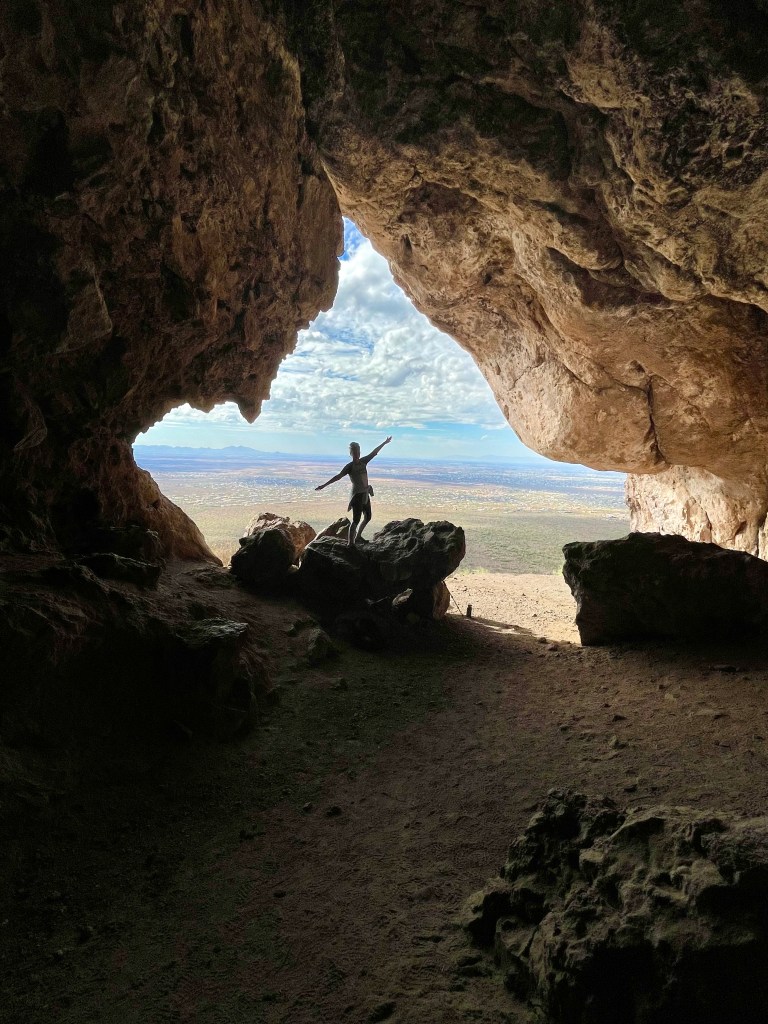
Broadway Cave Trail
Broadway Cave Trail is a great one – and it even has a cave at the end of it! Located in the Superstition Mountains near Apache Junction, this 4-mile round trip hike is considered a moderate one. With a final elevation of 1,000ft, the views from the top of the cave are INCREDIBLE! It’s also a great sunset hike as well.
It took us about 2 1/2 hours up and back, but we did take a wrong path on the way back, so consider that extra slip up. The trail is dog friendly, but not for younger kids. I would recommend downloading the trail on All Trails since it’s not well marked, and we did get off course a few times. Oh, and beware of bats in the smaller cave down inside the larger one. Enter at own risk.
How to Arrive: Take highway 60 East and turn left on Mountain View Road. Turn right on Broadway Ave and the parking will be on your left. The trailhead starts on the other side of the gated fence. The parking lot is pretty small and only fits about 9 cars. There are no restrooms, so go before you go!
Challenging to Difficult Hikes in Phoenix, Arizona
So you’re ready for a challenge? You’ve come to the right place! Phoenix has some of the most INCREDIBLE difficult hikes that are ready to be explored! Let’s get started.
Tom’s Thumb Trail, Scottsdale, AZ
Tom’s Thumb is one of the most popular trails in Scottsdale, and it’s easy to see why. Located in North Scottsdale, it’s considered challenging to difficult. Whereas Marcus Landslide takes you around the mountain, Tom’s Thumb takes you directly up. It’s a 4-mile round trip hike and runs about 2 ½ hours to complete with views to die for all the way up.
Tom’s Thumb: You’ll spot the back of the infamous thumb along the way up, but the front can be spotted once you reach the top. Reaching the thumb means you’ve reached the summit!

The trail is quite steep with loose gravel terrain. I slipped a few times, so make sure you wear proper hiking shoes (and trekking poles if you use them). If you’re hiking in summer, be aware of rattlesnakes. And because you’re heading to the top of the mountain, watch for coyote sightings too.
TIP: Bring binoculars with you because, at the top, you can see the entire Valley on a clear day.
How to Arrive: From the 101 Loop, take the Pima Road/Princess Drive exit. Go north on Pima Road and turn right on Happy Valley Road and again on Ranch Gate Road. You’ll see the Tom Thumb Trailhead sign – follow it to the parking lot. It’s also the same starting location as the Marcus Landslide Trail.
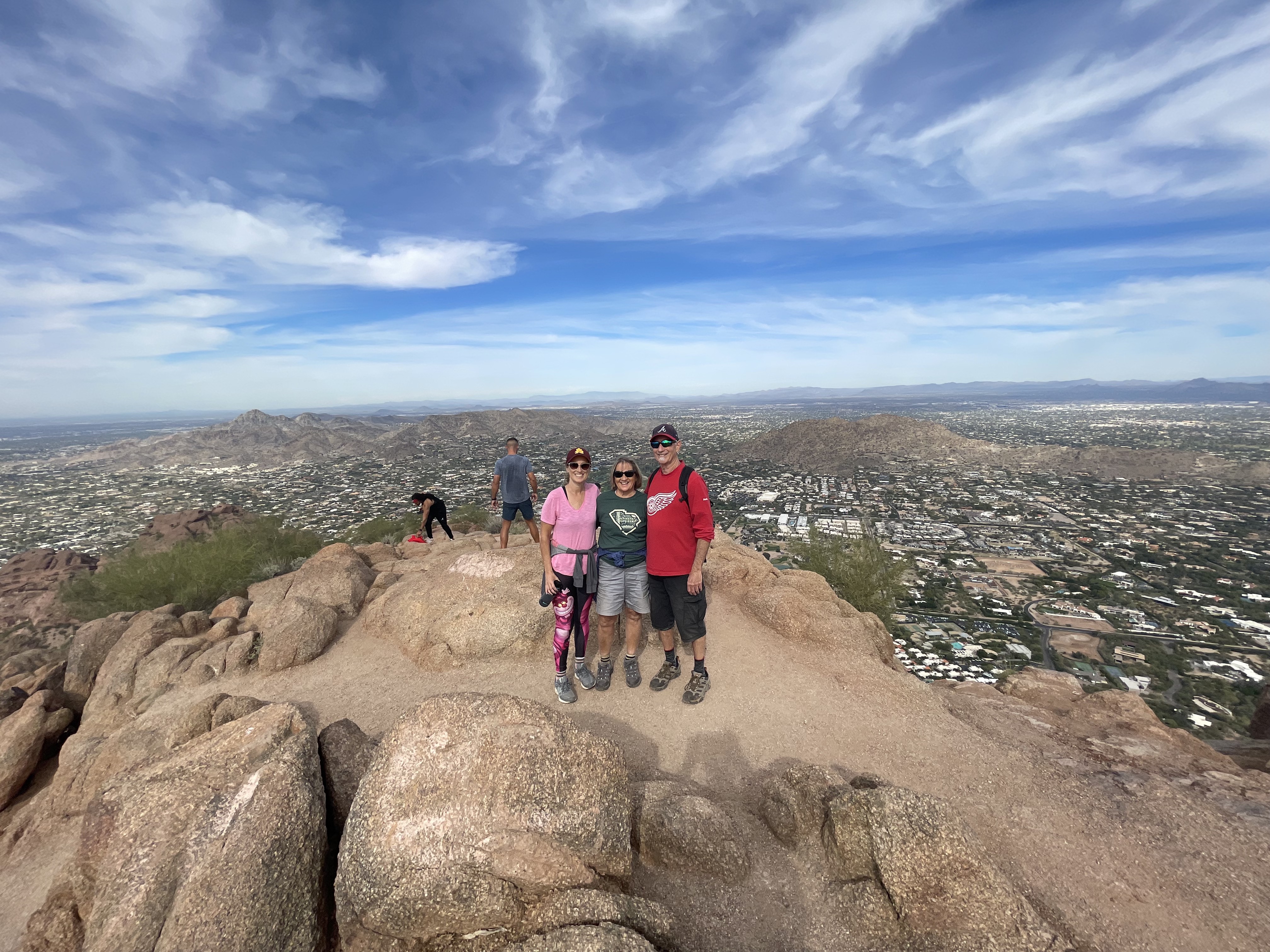
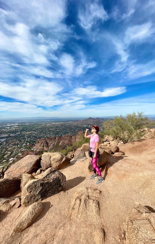
Camelback Mountain Echo Canyon Trail, Phoenix, AZ
Are you ready to tackle the KING of all trails in Phoenix? Then Camelback Mountain’s Echo Canyon Trail is where you should head. Located in the middle of the Valley in Paradise Valley, this hike has been rated extremely difficult and strenuous.
The hike takes between 2-3 hours, depending on your speed. It took us 1 1/2 hours to reach the summit and another hour to come back down. We took frequent water and photo-op stops along the way.
Because it’s one of the most popular hikes in Phoenix, be prepared for large crowds of hikers. The hike is basically in 3 stages:
- The first section is the steep trail hike (and the easiest part). There’s a sign at the end of this stage, conveniently letting you know that the hardest is about to come.
- Second, comes the two sections of steps (or railway ties, as they’re also called). This section is the steepest part of the trail. Yes, there are rails to help guide you along the way, but there are parts where it’s very difficult.
- The third section is made up of pure rocks and boulder climbing. Once you make it past the rocks, it’s a short trail up to the very top. And then you’ll feel like you’re on TOP OF THE WORLD!
This was honestly the most challenging hike I’ve ever completed, so the feeling of accomplishment was incredible! I still have to pinch myself sometimes when I drive by.
Tips for hiking Camelback Mountain
Bring LOTS of water & snacks for a break on the top. I also wish I had a pair of hiking gloves since I used my hands a lot during the rock climbing areas. It’s also a good idea to bring some band-aids or gauze. We all got a few cuts and scrapes along the way.
Needless to say, this trail isn’t for the faint of heart. Many people who think they can hike it end up hurt because they’re not ready. Pay attention to your body and know your limits.
BONUS: If you’re looking for the BEST hiking water bottle, check out our Water-to-Go bottles with a BUILT-IN PURIFICATION SYSTEM . It allows you to drink any water safely, eliminating 99% of all contaminants. I take it with me on every hike! And with our Coupon Code: NPTtrippers, you can take an additional 15% off any bottle!
How to Arrive: Located in the middle of the Valley, you can see the camel silhouette from pretty much any direction. Head toward Echo Canyon Pkwy and pull into the drop-off area. You can also park in the parking lot, but it fills up FAST!
Camelback Mountain Sweatshirt
And once you’ve conquered Camelback Mountain, make sure to show off your incredible accomplishment with my Mommy Mo Design, Camelback Mountain Embroidery Sweatshirts. Each sweatshirt is embroidered by yours truly. I personally designed the sweatshirt myself, and am super proud of this Camelback Mountain sweatshirt!
So show off your monumental hiking moment with our Camelback Mountain embroidery sweatshirt: I came. I hiked. I conquered:

BEST Hikes in Phoenix Arizona – PIN IT

Pingback: Everything You Need to Know about Hiking Camelback Mountain
Pingback: Sabino Canyon National Park - 10 Stunning Hiking Trails